
Target Market
Tesoli is an organization dedicated to serving several different businesses across the Greater Toronto area, sharing the highly-effective and money-saving benefits of 3D LiDAR scanning. This type of 3D high definition laser scanning is designed to gather large amounts of useful data in a quick and efficient manner, creating reports that clients can use to make further business decisions. Our community of clients and the target market our 3D scanning services spans a few different industries but is nonetheless accurate, advanced, and reliable. Discover how Tesoli’s laser scanning can improve your business and partner with us today!
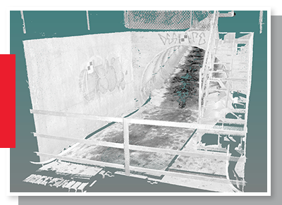
How Tesoli’s 3D LiDAR Scanning Improves Progress
The nature of our Tesoli 3D LiDAR scanning technology is focused entirely on providing professional, accessible data that business professionals can use to decide next steps. The high definition laser scanning we specialize in is the result of nearly 20 years’ worth of experience working in construction and real estate development from our owner, Luis Tracanelli, P.Eng. We understand how important it is to effectively gather information about a particular worksite in order to move forward with larger projects. This is why our state-of-the-art 3D LiDAR scanning is designed to gather detailed, accurate information about a certain space before any civil construction begins.
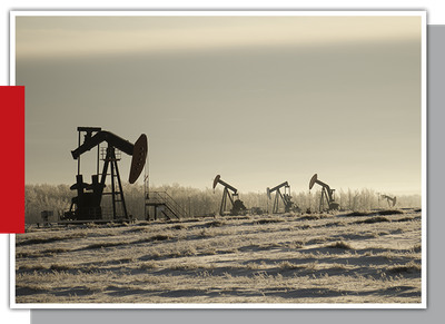
Oil & Gas Surveying Laser Scanning
One of the primary industries Tesoli’s 3D scanning serves is the Greater Toronto area’s oil and gas industry. Our high-definition laser scanning can help land surveyors, as well as oil and gas surveying personnel, determine if natural wells are located anywhere on the property; we understand how much the existence of these wells can affect the timeline and overall construction of a project, which is why we’re dedicated to helping gather this information. Tesoli’s laser scanning is capable of providing detailed reports of everything land surveyors may need to start drilling for oil and gas, including the presence of man-made objects, old wells, and scale models of new drilling sites.
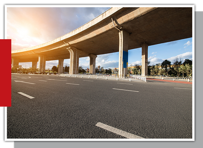
Transportation & Infrastructure 3D LiDAR Scanning
Tesoli 3D LiDAR scanning technology is also capable of helping professionals working in transportation and infrastructure have the information they need to make future projects run smoothly. Our high definition laser scanning experts can help provide data that illustrates in detail everything one needs to know before breaking ground on new civil construction. When it comes to building a new airport, airport runway, bridge, highway, pipeline, or railroad, it’s critical to know what exactly is going on underneath the surface. Tesoli’s 3D scanning technology is designed to provide detailed reports on where is best to start digging and what the exact measurements are to ensure a project is complete on-time and on-budget.
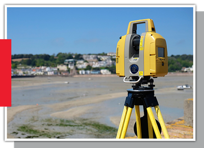
Land Development 3D Scanning
High definition laser scanning from Tesoli is perfect for land development professionals and employees who need accurate measurements and assessments in a timely manner. 3D LiDAR scanning is designed to provide an evaluation of the different all-natural and man-made formations present on-property; all this information is designed to make planning and plotting out each stage of land development projects easier. Both 2D and 3D scanning is available through Tesoli’s technology, capable of creating scale models and images of the finished structures and developments. Clients who work in and specialize in this industry can expect data with measurement up to 1mm.
Public Sector High Definition Laser Scanning
The world of civil engineering and development in the public sector can benefit greatly from 3D LiDAR scanning from Tesoli. Our technology’s reports and accurate data can help designers, construction crews, and project stakeholders make informed decisions on where it is best to break ground on new facilities. Tesoli is also capable of protecting public sector employees and keeping them safe by illustrating possible maintenance holes and chambers through high-resolution images.
Learn more about how Tesoli’s 3D LiDAR scanning technology can help you by contacting us today!